

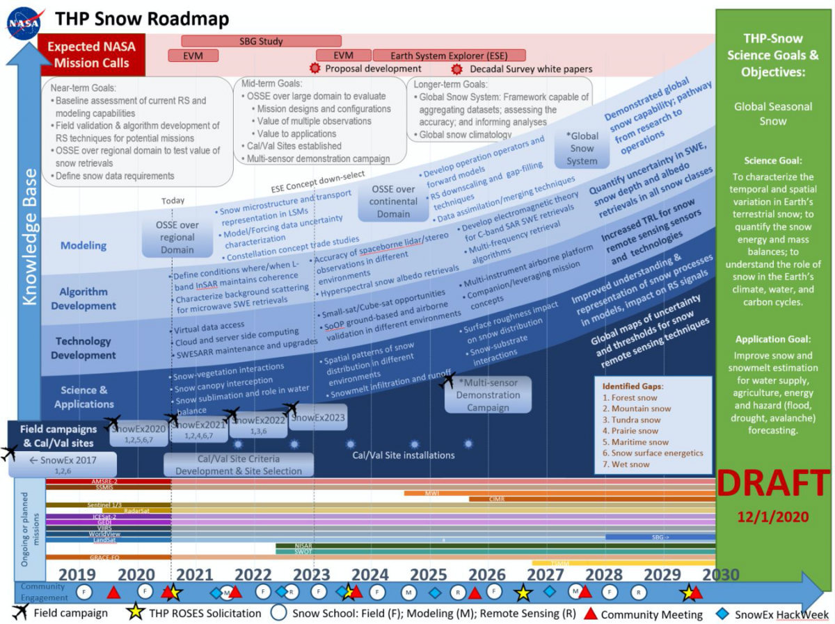
Knowing SWE is key for water conservation and allocation, and for assessing wildfire risk. Current remote sensing technologies for SWE include the attenuation of gamma rays emitted by the soil under snow, passive or active microwave emissions, and various methods of assessing snow depth, which is then multiplied by a known or assumed density. At coarse spatial scales (50 km blocks), SWE can be determined from detecting subtle changes in Earth’s gravity. Unfortunately, none of these technologies has reached a state of operational readiness and reliability.
For ecology, knowledge of snow depth is critical. Deep snow is an effective insulator, keeping the ground warmer than the air above. Snow protects plants from winter kill, but its insulating effects can also accelerate permafrost thawing. Deep snow poses challenges for large herbivores like elk, moose, and caribou by inhibiting their mobility and grazing. Snow depth can be measured remotely using airborne (and perhaps satellite) scanning lasers and altimeters, or using photogrammetric methods by differencing elevations of snow-free and snow-covered surfaces.
For climate, the extent and reflectivity (albedo) of snow is crucial. Most natural Earth surfaces (like soil and vegetation) absorb about 80 percent or more of solar energy, which results in warming, while fresh snow absorbs only about 10 percent, which helps in cooling. Less snow leads to more solar energy absorbed, further promoting warming and less snow in a feedback loop. Extent and reflectivity can be monitored remotely from aircraft or satellite, one technology in which we already have reasonable skill.
Other important attributes of the snow cover remain difficult or impossible to measure, such as snow contaminants, like soot and nitrate, snow strength (important for avalanche forecasting and military traffic ability assessments) and snow permeability (important for crop and soil ventilation beneath snow). However, combining existing and future remote sensing technologies with improved models may also allow us to infer these things, and to improve snow knowledge for hydrology, ecology, and climate.