

Western US Time Series Campaign
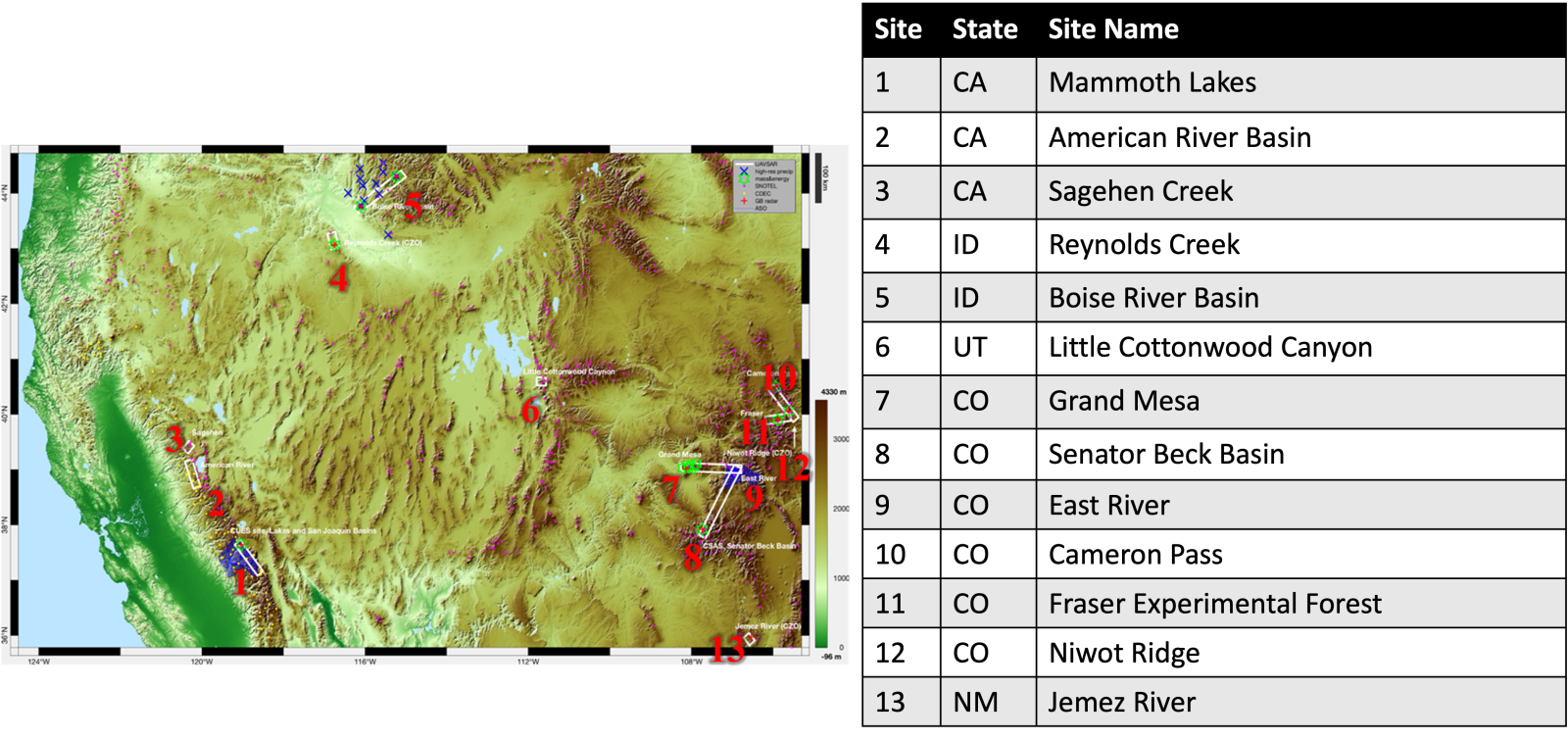
Thirteen study sites were selected across five states to cover a range of terrain and environmental conditions. The specific locations of the field experiments were chosen based on existing ground-based infrastructure, previous remote sensing experiments, and availability of local experienced observers. Priority was given to long-term snow observation sites, which provide climatological perspective, and sites with previous LiDAR acquisitions and available data. Each site has a designated site lead responsible for organizing the field effort and participants at that location in coordination with the airborne activities.
Grand Mesa Intensive Observation Period Campaign
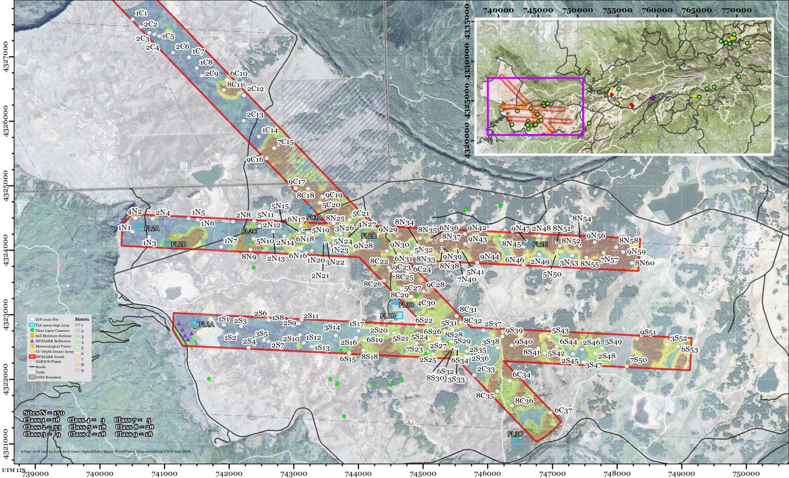
The 2020 IOP snow pit locations were selected using data from the SnowEx 2017 airborne lidar and optical imagery were analyzed. Specifically, the Airborne Snow Observatory’s 8 February 2017 lidar-derived snow depths classes: shallow (<90 cm), intermediate (90-122 cm), and deep (>122 cm). A tree density map created from November 2010 WorldView-2 imagery was also binned into three classes based on the percentage of tree-class pixels within a 50 m radius: treeless (0%), sparse (1-30%), and dense (31-100%). The two factors were combined to form a nine-point snow and tree matrix (Figure 1). Within this matrix, values 1-3, 4-6, and 7-9 represent treeless, sparse, and dense tree areas, respectively. These three ranges can be further subdivided into three categories of snow depth classification: shallow (lowest number in a range, e.g. 1), intermediate, and deep (highest number in a range, e.g. 3). Treeless areas were not split into shrub or meadow cover types. Water bodies and missing lidar data remain unclassified. Finally, the Grand Mesa IOP study site was clipped into three flight lines (north, N; south, S; and cross, C). These flight lines correspond to the scheduled IOP airborne observations. Within the flight lines, 150 snow pit locations (approximately three weeks of work) were proportionally divided by the nine matrix classes, then randomly distributed amongst the three flight lines for each matrix class. Matrix classes were not evenly represented and varied in frequency; for example, there are 3 Class 4 snow pits and 33 Class 2 snow pits.
For more information, read the User Guide published with the 2020 GM IOP Snow Pit Measurements