

UAVSAR
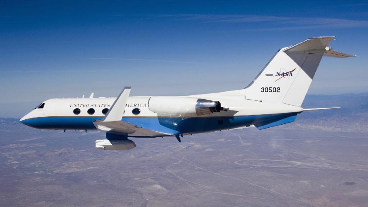
The Uninhabited Aerial Vehicle Synthestic Aperture Radar (UAVSAR) is an L-band (1.2 GHz) repeat-pass Interferometric Synthetic Aperture Radar (InSAR), designed to observe surface deformation caused by volcanic eruptions and earthquakes, and changes in vegetation and soil moisture. This mature NASA JPL instrument flies on a Gulfstream-III (G3) jet, with a precision autopilot which can repeat flight paths to within 10 meters. The UAVSAR instrument has an electronically scanned array antenna, which allows repeat-pass interferometry, even in varying wind conditions. The aircraft can survey for up to 7 hours before refueling, which allows all 13 SnowEx 2020 flight paths to be acquired in a single day, with one stop for refueling. L-band InSAR observations of amplitude and phase are used to measure phase changes between acquisitions. These phase changes can be related to changes in depth and SWE, and in theory when combined with LiDAR, could potentially explicitly map density in dry snow. When snow is completely dry, the radar time of flight through snow depends only on density; if snow depth is constrained by LiDAR, phase changes with these depths could be used to estimate radar velocity, and hence density.
LiDAR
The Airborne Snow Observatory (ASO) uses a scanning lidar and an imaging spectrometer for aerial surveys over snow-covered mountains which, when combined with baseline snow-free surveys, provide accurate high-resolution snow depth retrievals and information on snowpack reflectivity. As the spatial variability of snow water equivalent (SWE) is dominated by the snow depth variation, ASO combines these basin-scale snow depth measurements with modeled snow densities and in-situ data to generate high-resolution SWE data products. The resulting SWE maps (at 50 m resolution) provide the spatial distribution of water resources in the mountain snowpack at spatial scales relevant to physically-driven processes. Calibration and validation of other snow remote sensing approaches will likely be performed with the 3-meter snow depth product.
The ASO SWE maps are being assimilated into snow models for accurate instantaneous SWE representation, provide excellent evaluation data for alternative SWE estimation techniques including satellite-based and statistical products, and continue to provide SWE information late into the snowmelt season when automatic sensor locations have melted out. The ASO SWE products can also provide estimates of storm snow accumulation when flights bracket snow storm activity.
SWESARR
The airborne SWE Synthetic Aperture Radar and Radiometer (SWESARR) instrument was developed at NASA Goddard Space Flight Center. SWESARR has three active (including a dual Ku band) and three passive bands. Radar data is collected in dual polarization (VV, VH) while the radiometer makes single polarization (H) observations. The combination of all these microwave measurements will provide an important data set to develop and to enhance SWE retrieval algorithms.
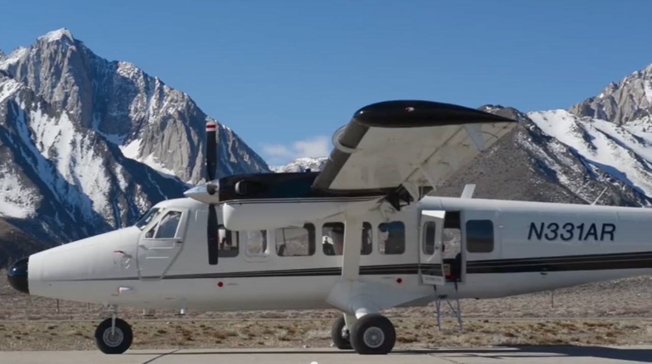
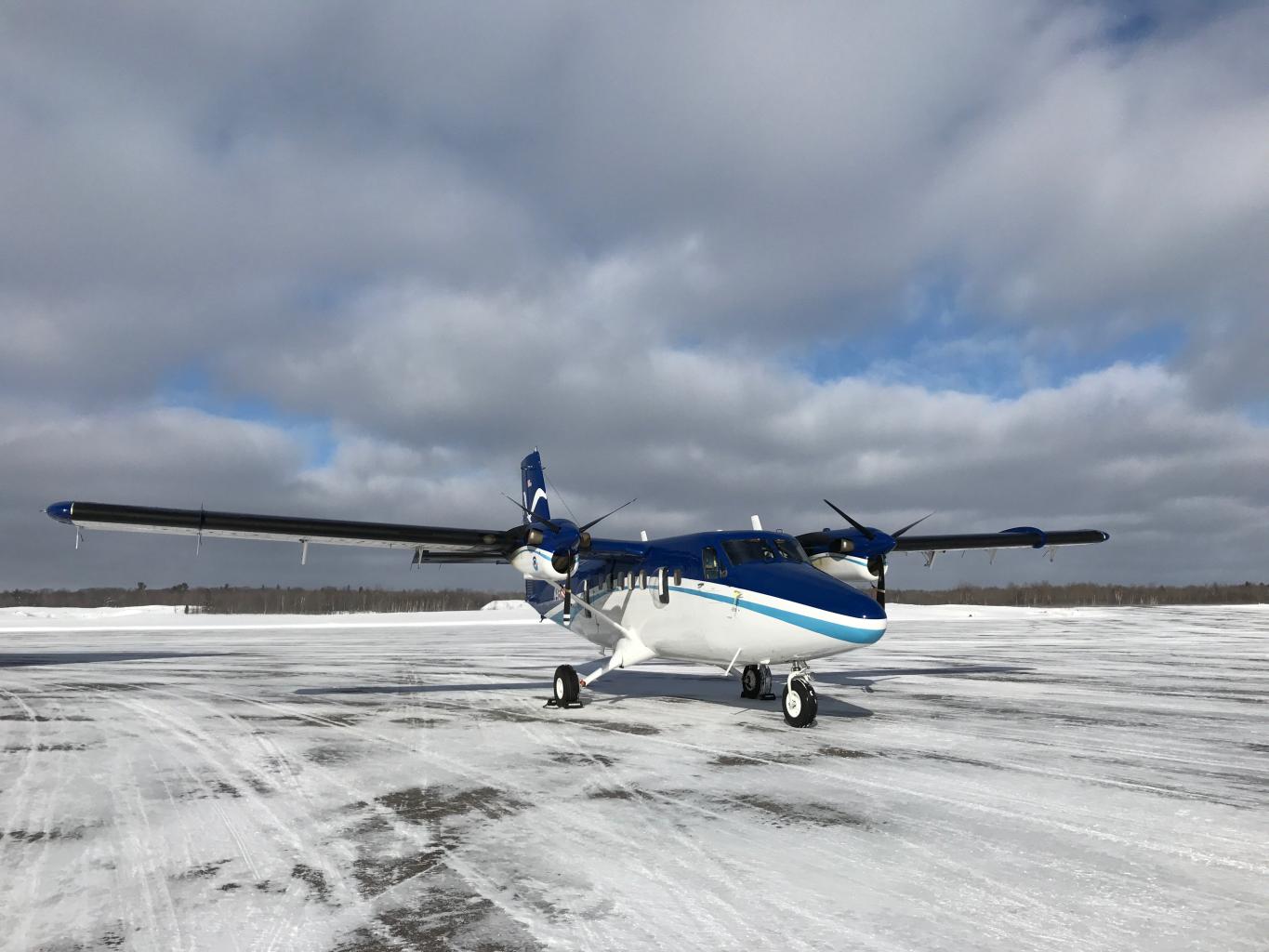
Radar and radiometer observations are sensitive to snow properties (e.g., microstructure, wetness) and vegetation and soil characteristics (e.g., state, moisture, roughness). To account for vegetation and soil contributions in the SWE algorithms, it is important to collect snow-off observations. Snow-off flights are scheduled for early November 2019. A minimal ground crew will be present to collect soil samples and move radar targets. Snow-on data collection will occur during the Grand Mesa Intensive Observation Period (IOP) in Jan/Feb 2020. SWESARR will be flown on a twin otter aircraft, from Twin Otter International (TOI), based in Grand Junction. At a flight altitude of 2 km, the SAR swath width ranges from 250 m to 450 m, as frequency decreases.
Thermal-IR
The Compact Airborne System for Imaging the Environment (CASIE), a suite of three thermal infrared (TIR) cameras, longwave radiometer, and visual band camera, will be flown on a Twin Otter aircraft, chartered by NASA through Twin Otter International and based out of Grand Junction CO airport. The system PIs are Chris Chickadel (University of Washington, Applied Phys. Lab.) and Jessica Lundquist (University of Washington, Civil and Env. Eng.). The system is moderately mature and has been used on snow temperature measurement campaigns over the northern California Sierras in 2016 and 2017, as well as several coastal oceanographic surveys from 2010-2018. During SnowEx flights, the system will record imagery and radiometry that will be post-processed to map calibrated snow, land, and tree surface temperature brightness over the study area. These maps will be used for validating snow thermal models and studying sub-pixel variability in snow temperature present in GOES16 satellite thermal imagery (2.4 km x 3.4 km pixel size). The CASIE will fly in the same aircraft as the NASA SWESARR instrument and although it will acquire data simultaneously, the two instruments will measure different locations on the ground, due to different viewing geometry.
University of Alabama SnowRadar
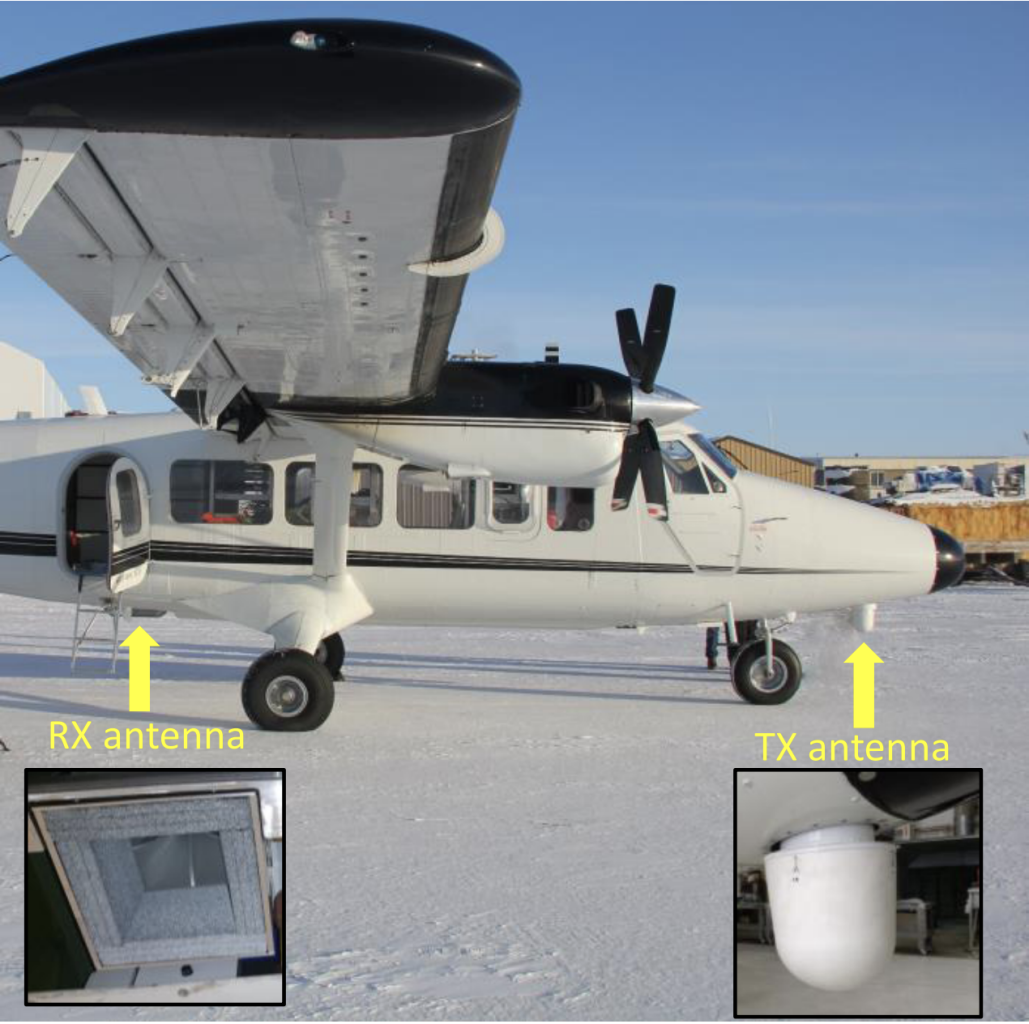
The University of Alabama’s Center for Remote Sensing, with funding from NOAA National Water Center, built an ultrawideband (UWB) 2-18 GHz FMCW radar system for mapping snow and soil moisture. It is similar to the system successfully flown as part of NASA Operation IceBridge over the past decade.
A first aircraft experiment with the University of Alabama UWB radar was completed over Grand Mesa, Colorado in late-March 2019, during which a field crew from NASA and CRREL performed ground-based measurements. Preliminary results are promising, and we plan to coordinate with the University of Alabama during SnowEx 2020 for additional Grand Mesa flights during the IOP.
NOHRSC
NOAA’s National Operational Hydrological Remote Sensing Center (NOHRSC) conducts regular airborne gamma surveys throughout the contiguous U.S. during winter to measure SWE. These surveys have been conducted for over 20 years and include a network of over 2100 operational flight lines; SWE estimates are produced as an average over the entire flight line. Snow survey aircraft are used to make near real-time, reliable, airborne SWE measurements which are used by the NWS Hydrologic Services Program when issuing spring snowmelt flood outlooks, water supply outlooks, and river and flood forecasts for the nation. NOHRSC has offered to conduct snow surveys over existing flight lines that correspond with SnowEx time series sites. In addition they will potentially add new flight lines over locations where flight lines currently do not exist, or to correspond to SnowEx planned collections.
NOHRSC also runs the SNOw Data Assimilation System (SNODAS) which is a modeling and data assimilation system that provides estimates of SWE, snow depth and other snowpack properties in support of hydrologic modeling and analysis for the contiguous United States (including lower portions of Canada). SNODAS simulates snow cover using a physically based, spatially-distributed energy- and mass-balance snow model with downscaled output from the Numerical Weather Prediction (NWP) models as forcing data (Carroll et al. 2001). SNODAS also assimilates satellite-derived observations of snow covered area, and airborne, and ground-based observations of snow depth and SWE. Gridded model outputs include snow depth, snow melt, SWE, and snow temperature. Additional outputs, including complete energy balance components are provided at assimilation points and available near real-time on their website. NOHRSC has offered to produce output data and display observations at the time series locations throughout the winter of 2019-20. This will provide updated information to the snow community and allow comparison between the ground observations and modeled data.