

UAVSAR
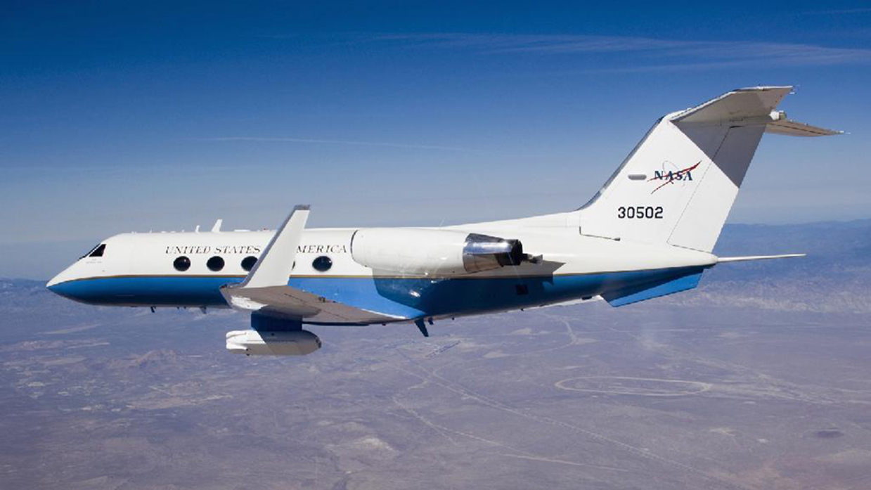
The Uninhabited Aerial Vehicle Synthestic Aperture Radar (UAVSAR) is an L-band (1.2 GHz) repeat-pass Interferometric Synthetic Aperture Radar (InSAR), designed to observe surface deformation caused by volcanic eruptions and earthquakes, and changes in vegetation and soil moisture. This mature NASA JPL instrument flies on a Gulfstream-III (G3) jet, with a precision autopilot which can repeat flight paths to within 10 meters. The UAVSAR instrument has an electronically scanned array antenna, which allows repeat-pass interferometry, even in varying wind conditions. The aircraft can survey for up to 7 hours before refueling, which allows all 13 SnowEx 2020 flight paths to be acquired in a single day, with one stop for refueling. L-band InSAR observations of amplitude and phase are used to measure phase changes between acquisitions. These phase changes can be related to changes in depth and SWE, and in theory when combined with LiDAR, could potentially explicitly map density in dry snow. When snow is completely dry, the radar time of flight through snow depends only on density; if snow depth is constrained by LiDAR, phase changes with these depths could be used to estimate radar velocity, and hence density.

AVIRIS-NG
The Airborne Visible InfraRed Imaging Spectrometer - Next Generation (AVIRIS-NG) has been developed to provide continued access to high signal-to-noise ratio imaging spectroscopy measurements in the solar reflected spectral range. AVIRIS-NG is expected to replace the AVIRIS-Classic instrument that has been flying since 1986. AVIRIS-NG measures the wavelength range from 380 nm to 2510 nm with 5 nm sampling. Spectra are measured as images with 600 cross-track elements and spatial sampling from 0.3 m to 4.0 m from a Twin Otter platform. In the future, a high altitude platform is expected to be available. AVIRIS-NG has better than 95% cross-track spectral uniformity and >= 95% spectral IFOV uniformity. Currently AVIRIS-NG flies on a King Air B200 operated by Dynamic Aviation Group Inc from Bridgewater, Virginia. The Kind Air B200 flies at a maximum altitude of 35 kft (10.6 km). NASA’s high altitude sensor platform, the ER-2 operated by NASA's Armstrong Flight Research Center, and another mid altitude aircraft, the DHC-6 operated by Twin Otter International Ltd (TOIL), are also available platforms. The main objective of the AVIRIS-NG is to support NASA science and applications by measuring spectra as images that record the interaction of light with matter. These spectra are used to identify, measure, and monitor constituents of the Earth's surface and atmosphere. For snow and ice hydrology, albedo, snow cover fraction, grain size, dust, impurities, and melting can be detected.
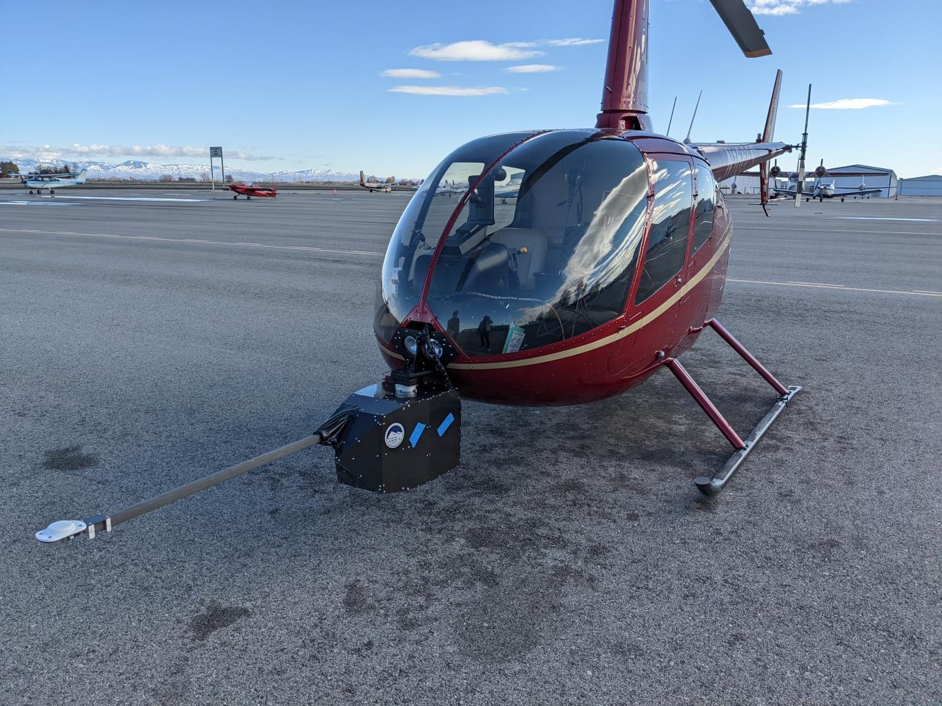
CRREL Helipod
The CRREL Helipod is an instrument package, co-developed by the U.S. Army Corps of Engineers’ Cold Regions Research and Engineering Laboratory (CRREL) and the National Center for Airborne LiDAR Mapping (NCALM), for integration onto a R-44 helicopter. This system includes a 1550 nm LiDAR, a Hasselblad A6D hyperspectral camera, and a FLIR thermal IR imager, and has been flown on many campaigns throughout the United States. R-44 helicopters are small with low flight ceilings; therefore the instrument will not deploy to any and high elevation western U.S. sites for SnowEx2021. CRREL is currently working to modify the Helipod for use on a larger, more common R-66 helicopter. As part of a DoD-funded snow project focused on remote sensing of vehicle mobility, this instrument package will be deployed during 2021 over lower elevation portions of the Idaho SnowEx 2021 sites.